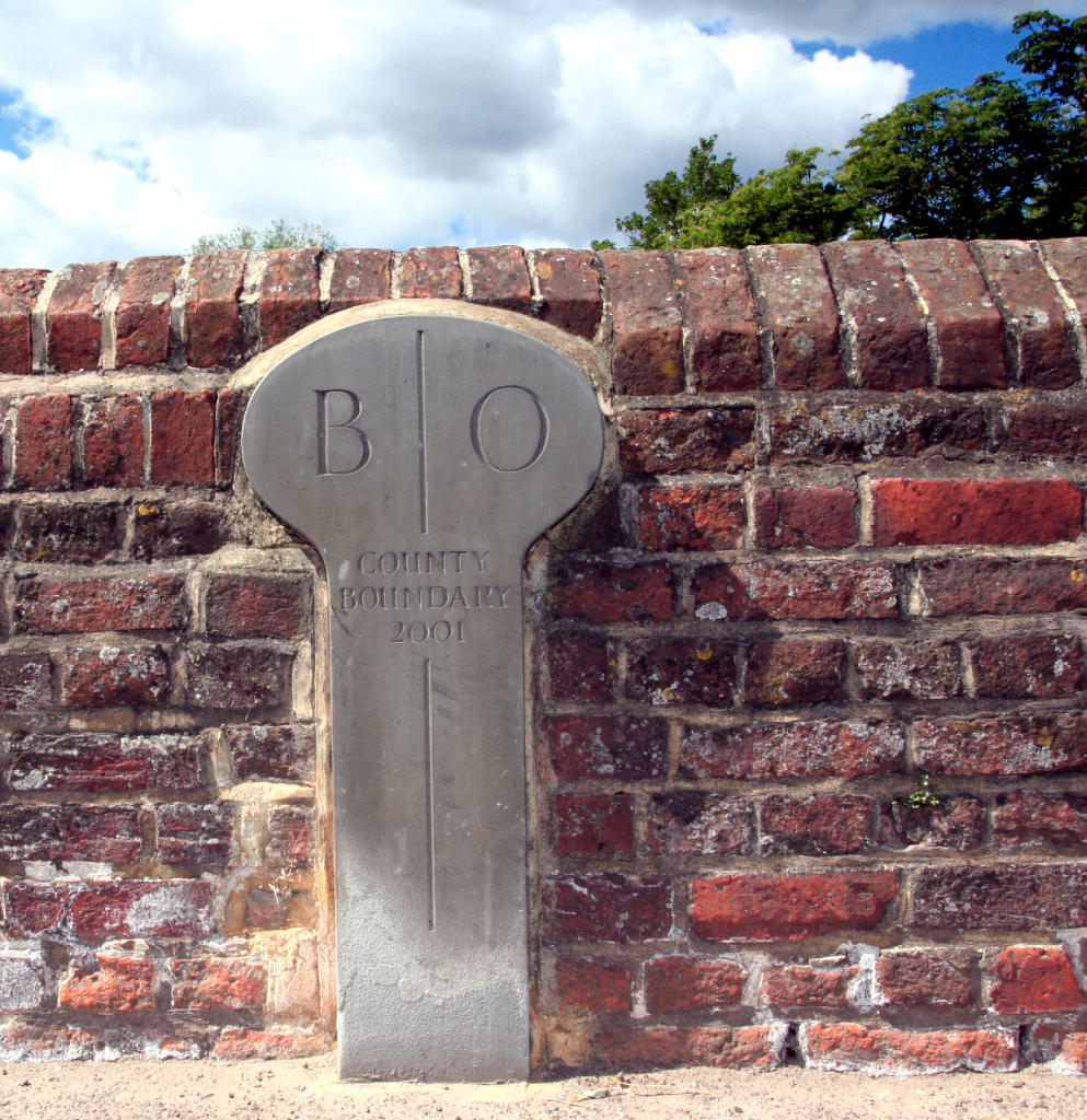
Perhaps there has been a county boundary stone or similar mark on nearby Sonning’s river bridge since it was first built. Puzzling at first sight! This one in my picture replaced an earlier version which had worn away to be illegible. The division between Oxfordshire and Berkshire often follows the imaginary centre of the river and is sometimes shown as such on old and recent maps. Here the marker states: B O County Boundary 2001.
Legend has it that this border line was used by the infamous highwayman Dick Turpin to his advantage by escaping from his aunt’s house in the village here after robbing travellers on the Bath Road. He would ride across the bridge and into the supposed safety of a different county. A property (or more than one?) in the area still includes the name Turpin as a nod to their historic past. Evidently, there was a time when he jumped out of the upstairs bedroom window and onto his horse waiting below, just as is depicted in films. Would the bridge back then have been an earlier wooden construction? One can image it rattling with the pounding horses hooves as he made his way towards our town and possibly out to nearby Stubbings where he had another sheltering house which is to this day also named “Turpins”. How much is legend and how much fact? Will we ever know?

Leave a comment